Friday, November 3, 2017

A Haunted Hike

We headed back to New Melones Lake for an overnight R&R.


We picked the Tuttletown Area in hopes of seizing a site in the Acorn Campground. Sadly, that area was closed for the season. So we meandered over to the Manzanita Campground area, which we were lucky to find site 86, a pull-through site at top of the hill and away from the crowd down by the lake. We prefer the Acorn Campground area, even though there isn't any great views of the lake, since the sites there are better designed for travel trailers.


Our closest neighbors were a couple of campsites away. It was very quiet since most folks were out on the lake fishing.


After setting up camp and eating lunch, we headed off to explore the hiking trails that we didn't hike in April. We hiked Fox Ravine over to Cougar Point to find the picnic table seen on the map and then down to the shore of the lake.


We were surprised that the water level of the lake was this low, but it's higher than the past couple of years.


The rock formation by the lake looks like trees (center grouping in photo) that have turned to stone. The pieces of stones have sharp edges that can easily be broken apart.


After investigating the shoreline, we headed back up the hill to continue our hike by following Black Bear Loop. The views were spectacular! The flat looking ridge is the Inverted Valley Butte that we hiked in April. From this vista, one can see that the butte goes for miles.


Leaving Black Bear Loop, we took the Kingsnake Loop back to our campsite. Along this route, we came across an unlucky deer that was right next to the trail. I'm glad to have seen it in this state versus half eaten and smelly.


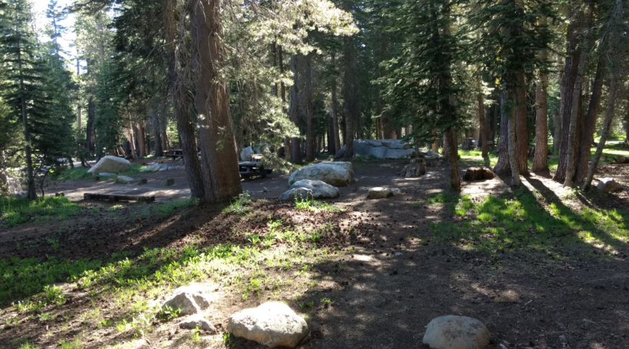
Back at camp, we rested. I took a short trek down the hill to look at the four walk-in campsites below our site. The walk-in sites are very nicely positioned sites, but I wouldn't want to lug camping gear down and then back up that hill. I was happy to have our comfy RV and not to have encountered any cougar, black bear, fox, or king snake on this trip. Instead, we watched the deer, California quail, and red-headed woodpecker enjoying the warm autumn day. 

Wednesday, October 11, 2017

A High Perch


We headed back to Black Oak Campground for the last weekend that the campground was open for the season. After setting up camp and having lunch, we took a hike along our favorite route by the campground to this overlook. Someone had placed a rusty chair on top of the rock for viewing.


Since all of the sites overlooking the valley were taken, we camped on the other side of the campground totally away from other campers. All the sites by us were empty.


The campground was very quiet since the campers were respectful adults.


Sunday we headed over to Pinecrest Lake to hike up to Cleo's Bath.


We hiked the beautiful trail up to where one has to start bouldering up the trail, the last portion to Cleo's Bath. We realized that this climb was too steep to do with our dog.


So instead, we headed back to hike around the lake. 


We hiked counterclockwise until we came to the dam. The trail continues over the dam. At first, we thought we couldn't cross over or use the trail since we didn't see anyone walking over the dam. And from our position on the trail above the dam, it looked like there wasn't a trail. Luckily that wasn't so since we didn't feel like hiking back the way we came.


The view looking down the dam from the trail on the dam. There were some people down there hiking.


As we continued our hike around the lake, we got a view of the canyon up to Cleo's Bath. Even though we didn't make it up to Cleo's Bath, our hike was wonderful and fun around this beautiful lake.

Sunday, September 3, 2017

Hiker's Paradise

We returned to Alpine Lake for three days to explore more of the wonderful trails from our campsite at Pine Marten Campground. Our first hike was Lakeshore trail that goes somewhat around Alpine Lake since we didn't do this hike on our last visit.


From our campsite we followed the Lakeshore trail on the south side of the lake to the dam. From there, the trail descends down and away from the dam to connect with a OHV trail, Slick Rock trail. We came across a couple that seemed lost. They had made it to the junction, but from the junction they didn't know which way to go since there isn't a sign pointing the direction back up to the lake. I didn't have a map, but knew the direction since I had memorized the map. We made a right at the trails junction, headed up the hill, past Emigrant trail on the left, and followed the road to the lake.


We then followed the paved trail that runs along the northern portion of the lake back to camp. At one point we were able to get a view of Inspiration Point.


This is a view of the direction of our second hike, Bee Gulch. After a good night's sleep and lazy morning, we headed off to explore the mountains north of the lake.


Our route was Bee Gulch. Since I had forgotten to bring maps on this camping trip, we didn't know the route, topography, and trails. This map doesn't show all the trails. There is a trail from Hwy 4, just west of the lake, to Bee Gulch called the Alpine Bypass trail.


Just after the water tank is the junction to the trails. We decided to explore the Alpine Bypass trail first before making the climb up Bee Gulch. That added another two plus miles to our excursion.


We passed by some Sierra Gooseberry plants. Thank God we didn't see a bear munching!


After returning to the Bee Gulch trail, the trail took us around some granite rocks, through a pine forest, across a creek, and up the side of a ridge for views of volcanic rocks. Rock formation similar to Inspiration Point and the Dardanelles.


Since we didn't know how much longer until the junction to the fire road and we were getting tired from the climb, we admired the views, noticed smoke just south-east of the Dardanelles, and then headed back down the trail to camp. Next time, I will remember to bring maps. Well, we have a reason to hike the Bee Gulch trail again, just to complete the trail.


On the way back down, we spotted this mushroom sweating in the hot alpine sun.


Back at camp, we rested before taking a drive east to see Mosquito Lake. We were lucky to get the same campsite as our last trip. All the snow had melted. Sadly, Meeks didn't have snow to munch.


In the morning, we awoke to a smoky sky. We started the climb up Inspiration Point, but we didn't get to the top since the view was terrible from the smoke and thunder could be heard in the distance. So we decided to head back to camp to relax a bit before packing up camp.


On the trek down, we spotted some lizards resting on this boulder. The boulder can be spotted on google maps.

Wednesday, July 19, 2017

Alpine Lake

The Sierra Mountains were calling us to come hike and camp. So, we packed up for an overnighter and headed away from the 100+ degree heat at home.  Yes, that's snow!


After setting up camp at Pine Marten and eating shrimp salad for lunch, we headed for a hike to Duck Lake.


Instead of finding ducks, we saw lots of geese that are spending their summer at 7,300 feet elevation trying to stay cool. The temperature for that day was 85 degrees.


Since the hike down to Duck Lake was only about a mile from the trailhead, we decided to hike around the lake to explore the other side of the lake. The trail was pretty and in numerous spots we lost the trail due to washouts from the spring melt. There are lots of fallen trees in the dense forest on the east side of the lake.


The views of the lake and granite mountain range are best seen on the west side of the lake. We didn't see any snow patches along our hike.


Back at camp, we enjoyed a relaxing and quiet Sunday afternoon with the cool, pine breeze blowing through our campsite.


Most of the campers had left earlier in the day; so, four of the campsites by our site were empty.


All of the campsites located on the road to the right were empty too. There were some very nice sites for RVs on that section of the campground. One site in complete shade. Most of the campers were at the sites by the lake, which surprisingly was warmer there by the lake.


Through the trees, off on the right by the large log was a little pond that had formed from melted snow. Also, the trailhead to Inspiration Point was off on the left. Numerous cars were parked to the left of the photo, but by evening only one car was left.


After a good nights sleep and yummy breakfast, we hiked up to Inspiration Point. It was a steep climb to the lower level of the point.


We were rewarded with a wonderful view of Alpine Lake. The campground is off to the right of the photo. We could see folks kayaking and enjoying their day on the lake.


We scrambled higher for even more spectacular views.


We were delighted and surprised to see Utica, Union, Spicer Reservoirs. Basking in the view brought back wonderful memories of tent camping at Utica with our children over ten years ago. We could even spot the island which we canoed out to explore with the kids and Meeks.


And we had a view of the Dardanelles with the snowy mountains of the Emigrant Wilderness behind. Last August, we hike with daughter to Sword Lake just below the Dardanelles, http://tootlingaroundamt.blogspot.com/2016/08/.


The Dardanelles and Inspiration Point are like volcanic islands in a sea of granite. Glaciers eroded most of the volcanic rock and left moraines of granite. The Dardanelles are another example of an inverted volcanic river topography.


Back at camp, we relaxed before packing up and heading home to the heat of the Bay Area. We are looking forward to coming back here to explore more of this beautiful region of the Sierra Mountains.


Monday, June 5, 2017

Squaw Valley Creek Trail

Day three, we hiked an 8 mile loop that starts by crossing over a small footbridge by the Cabin Creek Trailhead to the PCT footbridge that crosses Squaw Valley Creek.


The directions for the hike states not to cross the PCT footbridge. After exploring the bridge and pretty gorge, we head up to where the PCT splits to the right.


We hike the loop counterclockwise. After hiking along the PCT for about a mile, we arrive at the junction of trails called the "Octopus".  We head down the inviting fire road listening to numerous birds singing to each other.  We were happy to be walking under the canopy of fir, pine, cedar, black oak, and dogwood trees since it was very hot, 90s.


We hear the Bear Trap Creek to the right, which is located way below the fire road at the start of our descent. As we descend, we notice many springs and seasonal creeks feeding into Bear Trap Creek. Once the road levels out, we cross a vehicle bridge. In the pool by the bridge are numerous Umbrella plants or Indian Rhubarb.


This region of Northern California is so much greener and healthier looking than Central California.  We stop to put on the extensions of our pant legs since the next section of the loop will take us through sections where poison oak grows profusely along sections of the trail. Mainly the first mile from the junction of the fire road and the Squaw Valley Creek Trail, aka Cabin Creek Trail, has the densely patches of poison oak. We were happy we were hiking this in the spring and not late summer when the poison oak would be covering the trail.


The Squaw Valley Trail follows the Squaw Valley Creek until it connects to the PCT. As we got closer to the PCT, about half way into the hike along the Squaw Valley Creek, the trail improves. We stop at an opening along the trail to look at a falls, rest, and eat a snack.


So many flowering plants line the rocky gorge in this area. After a relaxing rest, we continue the gentle climb back to the trailhead. We only came across three folks that walked from the trailhead to the PCT bridge and back. Later that evening, we saw them at Fowlers Camp. They had explored numerous places by car that day.


Our drive back to McCloud on Squaw Valley Creek Road provided us with such a rewarding surprise, majestic Mt. Shasta.


I was so pleased to have found this hike:https://hikemtshasta.com/mccloud-river-trails/squaw-valley-creek-trail/.


https://www.fs.usda.gov/Internet/FSE_DOCUMENTS/fsm9_008599.pdf

There are so many more beautiful places in this region of Mt. Shasta that my husband and I are looking forward to exploring.


Part 3 of Mt.Shasta/ McCloud