Showing posts with label Alpine Lake. Show all posts

Wednesday, October 19, 2022

Pine Marten the Campground not the Animal

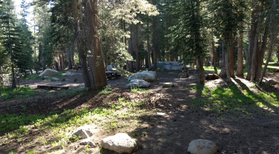
 After five years of waiting for a site, campground was closed for a year and then covid, we snagged a spot at Pine Marten campground by Alpine Lake in Bear Valley. 

The first night, Friday night, the campground was very quiet since most campers were coming in on Saturday. 

The sites beside us were all taken with older folks that go to sleep early. Yes, that is our campfire! 😂


To get acclimated to the elevation of 7,335 feet, we did an easy five mile hike around the lake on Friday. The water level is low, but surprisingly not as low as other lakes in California. This might be due to the fact that this is an alpine lake.


On the south side of the lake we only saw one other person and on the west side only a 4x4 coming back from Slick Rock on the 4x4 trail. 


The north side of the lake has more folks all due to the proximity to Hwy 4 and a paved walking trail. The arrow is pointing at Inspiration Point. A fun hike up to the first vista point with a spectacular view south with sight of Utica Lake, Union Lake, and Dardanelles.  We have never made it to the very top and never will due to the very narrow trail at the last portion of the trail that has many areas with loose small rocks. That last section is just way too dangerous for this old gal.


OMG! What happened to that picnic table? Heavy Snow! The picnic table was put on soft soil and a heavy snow pack sunk the table. We saw many tables like this on the north side of the lake. South side of lake doesn't have any picnic tables.


The view from south of the lake looking north gave us a peek of Saturday's hike, that high ridge.


Saturday's two mile hike up Bee Gulch trail to this point was strenuous, beautiful, and very rewarding. The elevation gain was about 1,000 feet. This was an awesome view of the Dardanelles and south towards Yosemite.


Eating lunch before taking the grueling 4x4 trail down to Hwy 4 and back to Alpine Lake.  I thought the 4x4 trail was a fire road. It might have been a long time ago, but now it is a very rocky road. Some sections that we descended were so difficult due to the soft dirt and small rocks on a very steep grade. I can't believe we hiked down that way. That hike tired me out! 


This old gal is very happy with flat trails like this! 


Sunday, September 3, 2017

Hiker's Paradise

We returned to Alpine Lake for three days to explore more of the wonderful trails from our campsite at Pine Marten Campground. Our first hike was Lakeshore trail that goes somewhat around Alpine Lake since we didn't do this hike on our last visit.


From our campsite we followed the Lakeshore trail on the south side of the lake to the dam. From there, the trail descends down and away from the dam to connect with a OHV trail, Slick Rock trail. We came across a couple that seemed lost. They had made it to the junction, but from the junction they didn't know which way to go since there isn't a sign pointing the direction back up to the lake. I didn't have a map, but knew the direction since I had memorized the map. We made a right at the trails junction, headed up the hill, past Emigrant trail on the left, and followed the road to the lake.


We then followed the paved trail that runs along the northern portion of the lake back to camp. At one point we were able to get a view of Inspiration Point.


This is a view of the direction of our second hike, Bee Gulch. After a good night's sleep and lazy morning, we headed off to explore the mountains north of the lake.


Our route was Bee Gulch. Since I had forgotten to bring maps on this camping trip, we didn't know the route, topography, and trails. This map doesn't show all the trails. There is a trail from Hwy 4, just west of the lake, to Bee Gulch called the Alpine Bypass trail.


Just after the water tank is the junction to the trails. We decided to explore the Alpine Bypass trail first before making the climb up Bee Gulch. That added another two plus miles to our excursion.


We passed by some Sierra Gooseberry plants. Thank God we didn't see a bear munching!


After returning to the Bee Gulch trail, the trail took us around some granite rocks, through a pine forest, across a creek, and up the side of a ridge for views of volcanic rocks. Rock formation similar to Inspiration Point and the Dardanelles.


Since we didn't know how much longer until the junction to the fire road and we were getting tired from the climb, we admired the views, noticed smoke just south-east of the Dardanelles, and then headed back down the trail to camp. Next time, I will remember to bring maps. Well, we have a reason to hike the Bee Gulch trail again, just to complete the trail.


On the way back down, we spotted this mushroom sweating in the hot alpine sun.


Back at camp, we rested before taking a drive east to see Mosquito Lake. We were lucky to get the same campsite as our last trip. All the snow had melted. Sadly, Meeks didn't have snow to munch.


In the morning, we awoke to a smoky sky. We started the climb up Inspiration Point, but we didn't get to the top since the view was terrible from the smoke and thunder could be heard in the distance. So we decided to head back to camp to relax a bit before packing up camp.


On the trek down, we spotted some lizards resting on this boulder. The boulder can be spotted on google maps.

Wednesday, July 19, 2017

Alpine Lake

The Sierra Mountains were calling us to come hike and camp. So, we packed up for an overnighter and headed away from the 100+ degree heat at home.  Yes, that's snow!


After setting up camp at Pine Marten and eating shrimp salad for lunch, we headed for a hike to Duck Lake.


Instead of finding ducks, we saw lots of geese that are spending their summer at 7,300 feet elevation trying to stay cool. The temperature for that day was 85 degrees.


Since the hike down to Duck Lake was only about a mile from the trailhead, we decided to hike around the lake to explore the other side of the lake. The trail was pretty and in numerous spots we lost the trail due to washouts from the spring melt. There are lots of fallen trees in the dense forest on the east side of the lake.


The views of the lake and granite mountain range are best seen on the west side of the lake. We didn't see any snow patches along our hike.


Back at camp, we enjoyed a relaxing and quiet Sunday afternoon with the cool, pine breeze blowing through our campsite.


Most of the campers had left earlier in the day; so, four of the campsites by our site were empty.


All of the campsites located on the road to the right were empty too. There were some very nice sites for RVs on that section of the campground. One site in complete shade. Most of the campers were at the sites by the lake, which surprisingly was warmer there by the lake.


Through the trees, off on the right by the large log was a little pond that had formed from melted snow. Also, the trailhead to Inspiration Point was off on the left. Numerous cars were parked to the left of the photo, but by evening only one car was left.


After a good nights sleep and yummy breakfast, we hiked up to Inspiration Point. It was a steep climb to the lower level of the point.


We were rewarded with a wonderful view of Alpine Lake. The campground is off to the right of the photo. We could see folks kayaking and enjoying their day on the lake.


We scrambled higher for even more spectacular views.


We were delighted and surprised to see Utica, Union, Spicer Reservoirs. Basking in the view brought back wonderful memories of tent camping at Utica with our children over ten years ago. We could even spot the island which we canoed out to explore with the kids and Meeks.


And we had a view of the Dardanelles with the snowy mountains of the Emigrant Wilderness behind. Last August, we hike with daughter to Sword Lake just below the Dardanelles, http://tootlingaroundamt.blogspot.com/2016/08/.


The Dardanelles and Inspiration Point are like volcanic islands in a sea of granite. Glaciers eroded most of the volcanic rock and left moraines of granite. The Dardanelles are another example of an inverted volcanic river topography.


Back at camp, we relaxed before packing up and heading home to the heat of the Bay Area. We are looking forward to coming back here to explore more of this beautiful region of the Sierra Mountains.