Showing posts with label Stanislaus Hwy 4. Show all posts

Wednesday, October 19, 2022

Pine Marten the Campground not the Animal

 After five years of waiting for a site, campground was closed for a year and then covid, we snagged a spot at Pine Marten campground by Alpine Lake in Bear Valley. 

The first night, Friday night, the campground was very quiet since most campers were coming in on Saturday. 

The sites beside us were all taken with older folks that go to sleep early. Yes, that is our campfire! 😂


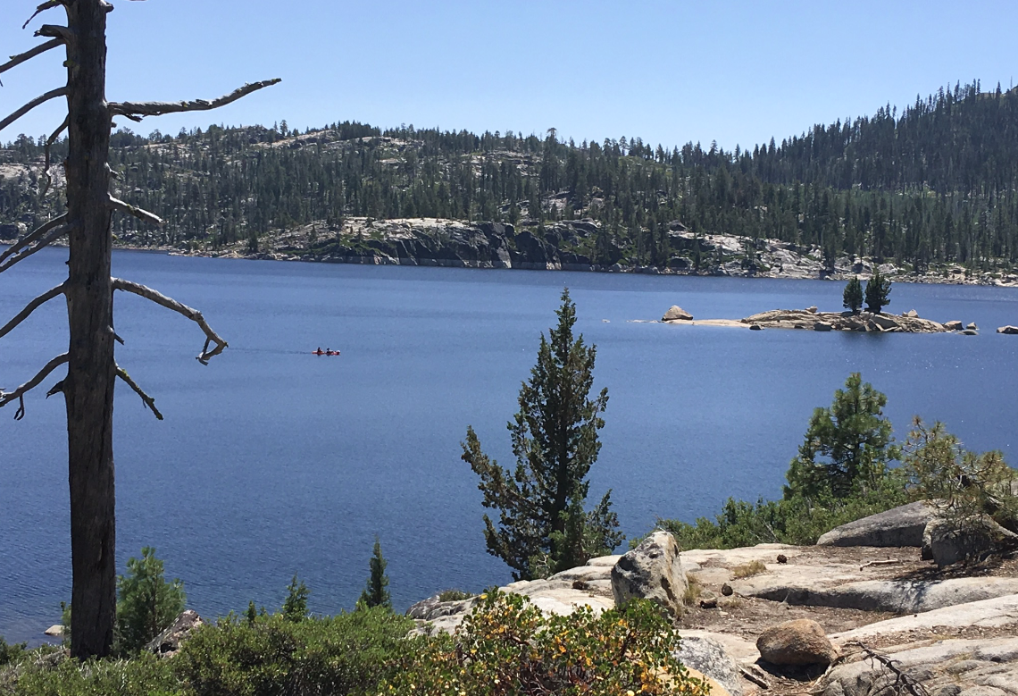
To get acclimated to the elevation of 7,335 feet, we did an easy five mile hike around the lake on Friday. The water level is low, but surprisingly not as low as other lakes in California. This might be due to the fact that this is an alpine lake.


On the south side of the lake we only saw one other person and on the west side only a 4x4 coming back from Slick Rock on the 4x4 trail. 


The north side of the lake has more folks all due to the proximity to Hwy 4 and a paved walking trail. The arrow is pointing at Inspiration Point. A fun hike up to the first vista point with a spectacular view south with sight of Utica Lake, Union Lake, and Dardanelles.  We have never made it to the very top and never will due to the very narrow trail at the last portion of the trail that has many areas with loose small rocks. That last section is just way too dangerous for this old gal.


OMG! What happened to that picnic table? Heavy Snow! The picnic table was put on soft soil and a heavy snow pack sunk the table. We saw many tables like this on the north side of the lake. South side of lake doesn't have any picnic tables.


The view from south of the lake looking north gave us a peek of Saturday's hike, that high ridge.


Saturday's two mile hike up Bee Gulch trail to this point was strenuous, beautiful, and very rewarding. The elevation gain was about 1,000 feet. This was an awesome view of the Dardanelles and south towards Yosemite.


Eating lunch before taking the grueling 4x4 trail down to Hwy 4 and back to Alpine Lake.  I thought the 4x4 trail was a fire road. It might have been a long time ago, but now it is a very rocky road. Some sections that we descended were so difficult due to the soft dirt and small rocks on a very steep grade. I can't believe we hiked down that way. That hike tired me out! 


This old gal is very happy with flat trails like this! 


Sunday, August 18, 2019

Spicer Reservoir

It's been twelve years since we last camped up around the Spicer area of the Stanislaus NF. Utica was our favorite place to car camp before a Sunset magazine article informed folks of peaceful Utica.


Now that we have a travel trailer, I wouldn't take my RV down to Utica. Plus, during the peak months of summer the lake is always crowded with campers, even midweek.


Our plan for the weekend was to head back to Pine Marten at Alpine Lake since it had been two years since our last visit. I wanted to hike Bee Gulch trail (part of the Tahoe-Yosemite Pack Trail system), but a huge event was happening that weekend in Bear Valley, which we didn't know until we got there. All the camping sites around Alpine lake were taken.


So we headed to our backup, Spicer. We nervously drove the 8 some miles down to Spicer campground hoping that there would be at least one site still vacant since Spicer is out of the way from Hwy 4 and the event. To our surprise half the campground was vacant. We were told if we had come last weekend we wouldn't have found a site. Since schools already started in the Central Valley and most of the schools in the Bay Area were starting Monday, we got lucky with lots of vacant sites to pick from.


We picked site 6, a mainly private wooded site.  Our closest neighbors were in sites 4 and 7, which were quiet senior citizens with their huge RVs.


It had been at least 17 years since we camped at Spicer campground. We had forgotten the beauty of this area. The water was never this high in the numerous times we visited the lake while camping in this area. The views looking at the Carson-Iceberg Wilderness and the Dardanelles are truly stunning.


After settling in and having lunch, we headed up to Elephant Rock Lake for a hike to Rock Lake. This area too had changed.


Elephant Rock Lake seemed larger than we remembered it. This could be true since this year the Sierras had lots of snow. We remembered a much small lake with lots of waterlilies covering the entire lake.


We headed off to Rock Lake in the Carson-Iceberg Wilderness after taking a peek of Elephant Rock Lake. The trail we took was the one we took 12 years ago with our kids. This trail isn't on a couple of today's internet maps, but the trail is still well used and marked. A marker sit close to the wilderness sign.


About 13 years ago there was a forest fire here that burnt a large area of the forest close to the trail.


It was wonderful to see the new growth, all about 6-7ft in height. Beautifully shaped Christmas trees. We noted three different types of evergreen: spruce, pine, and fir. There are lots of dead trees that have fallen. Those decaying trees will bring nutrients to the new growth as well as to the alpine flowers: Indian Paintbrush and Woolly Sunflower.


We did a lot of climbing over downed trees that had fallen over the trail in the 2 miles that it took to reach Rock Lake. A great butt workout!


Rock Lake also looked a lot larger than what we remember. Again, this winter had a huge snow fall; so, we are most likely seeing the effects from the melting snow. This is only a small portion of the lake, western end. The trail traverses to the eastern end of the lake where the trail meets up with the Tahoe-Yosemite Pack Trail that passes by Alpine Lake. After a peaceful rest at the lake, we headed back to the car and then camp for a relaxing evening and yummy meal of Pad Thai.


Then next morning, we hiked and explored the road down to the dam. Along the way we came upon these large pulleys and then...


...this stone with the information on Martin McDonough, who was responsible for bringing a community together in seeing the importance of the power and purpose of the water in this region.


While hiking down to the shoreline, we noticed a couple of fire rings close to the shore.


We will not wait another seventeen years to venture back to Spicer Family Campground. Yes, it's now on our favorite places to RV camp! Next time, we will hike from Elephant Rock to Duck Lake. 

Wednesday, May 1, 2019

Seasonal Creeks and Waterfalls

We headed back to Wakalu Hep Yoo Campground off of Hwy 4 this past weekend.


Nobody was around our location of the campground. Everyone wanted to be at the end or back where it was dark and wet.


We were at site 2, which is located across from the camp host site and near the exit and entrance. Not even the camp host had arrived for the first weekend of the season.


That's correct! Nobody was around us. It was like we had the entire campground to ourselves. Just the way we like it, peace and quiet.


When we camped here last fall, this creek wasn't flowing. This is close to the entrance to the campground. We could hear this creek and the river from our site, a very soothing sound.


Luckily for us, a very large group of off-road vehicles had finished their touring of the road we wished to hike. They were all parked at the day-use area, Sourgrass, when we headed up the road to explore what mother-nature had created.


We were surprised at the numerous seasonal creeks that we encountered. Last fall the road was dry and there was only one creek to cross.


This is what the creek looked like in the fall.


And this is what the creek looks like this spring. We couldn't even cross the creek to continue on the road.


So as we headed back, we enjoyed the waterfalls.


One creek had numerous falls. If we were younger and willing to climb up the hill, it would have been fun to explore those falls too.


After a relaxing evening and a peaceful sleep, we explored other areas of the campground and found this snow plant hiding under a young pine.


The path under the bridge lead to this swollen creek. We didn't feel like crossing what looks to be a slippery bridge.


So instead, we crossed the bridge and explored a portion of the trail across from the day-use area before heading back to camp for lunch and breaking camp. Next time we visit here we will explore the rest of that trail.

Thursday, September 13, 2018

Wild River and Rattlesnake Creek

Wakalu Hep Yo means wild river. For 2000 years, the Miwok lived here seasonally in this beautiful canyon.


We went for a weekend visit to explore this canyon located in the Stanislaus NF off of Hwy 4.


We snagged a site away from the large group of tent campers. There was only the camp host four sites down from us, which we could not see or hear the host from our site. The other three sites on our side of the street were empty.


Our dog guarded us from some small critter looking for food. Those killer chipmunks just need to be kept away from the RV and us.


Our site was level and clean. This campground is setup for mainly tent camping. There are some spots for small travel trailers.


We were perched up high and away from the other loops of the campground.


After settling in and eating lunch, we headed over to the day-use area to hike Rattlesnake Creek Road, 5N02R.


This is a forest road that high clearance vehicles can use to get back to some wonderful camping sites and fishing spots along the North Fork Stanislaus River. This portion of the road looks ok, but the beginning portion and other sections are either very rocky with boulders or huge dips from seasonal creeks.


A pole adjustment needed to be made for hiking over the boulders.


A good portion of this road parallels the river. A jeep loaded down with folks checking out some fishing spots drove by us.


A couple of times the road veers away from the river, which took us into a densely wooded area of sequoias. Calaveras Big Trees isn't that far away from here, which has numerous "big trees".


But we enjoyed this quiet and peaceful hike in the less popular area of the Stanislaus NF. We were the only folks hiking the road. The jeep was the only vehicle that drove by and there was only one group of campers down by the river off of a spur road.


Continuing down the road, the road crosses the Rattlesnake Creek, which makes for a wonderful place to stop for a cold dip in the deep pool by the road. The weather was warm enough for a dip, but we didn't even soak our feet in the cold water.


Instead, we kept hiking until we came to the end of the road where we were greeted by cows trying to keep cool in the shade of the pines. From there we turned around to explore the spur road before heading back to camp.


We had to cross the ruff terrain of the road before making it back to the entrance by the day-use area. I have no idea how one drives over this section with the dips and boulders without causing damage to the undercarriage of their vehicle. We saw numerous areas which looked like oil leaked onto the boulders.


Back at camp, we called it a day of hiking. We rested and read about other places in the Stanislaus NF to explore.


After an extremely quiet evening and falling asleep to the sound of crickets, we awoke to explore more of the campground. We discovered a trail by the bridge and river that looked interesting to explore. One section of the trail starts at the bridge and goes to the back loop of the campground.


Beside the trail is an amphitheater area with a Miwok hut.


The hut wasn't very large, but I'm sure it served its purpose.


We back tracked to the bridge by way of walking the road through the campground and then a side trail down to the main trail. After crossing under the bridge we only walked a short distance to a manmade overlook.


The river is flowing fast through this section by the overlook.


Downstream were two guys fishing at a quiet pool of the river. They must of scrambled over the boulders to get to that spot.


The day was warming up quickly; so, we headed back to camp, rested a bit, and then packed up. Wakalu Hep Yo is a wonderful place to explore. Maybe we will return in the spring to check the river and plants that time of year. For now, we will explore other regions of the Sierras.