Thursday, September 13, 2018

Wild River and Rattlesnake Creek

Wakalu Hep Yo means wild river. For 2000 years, the Miwok lived here seasonally in this beautiful canyon.


We went for a weekend visit to explore this canyon located in the Stanislaus NF off of Hwy 4.


We snagged a site away from the large group of tent campers. There was only the camp host four sites down from us, which we could not see or hear the host from our site. The other three sites on our side of the street were empty.


Our dog guarded us from some small critter looking for food. Those killer chipmunks just need to be kept away from the RV and us.


Our site was level and clean. This campground is setup for mainly tent camping. There are some spots for small travel trailers.


We were perched up high and away from the other loops of the campground.


After settling in and eating lunch, we headed over to the day-use area to hike Rattlesnake Creek Road, 5N02R.


This is a forest road that high clearance vehicles can use to get back to some wonderful camping sites and fishing spots along the North Fork Stanislaus River. This portion of the road looks ok, but the beginning portion and other sections are either very rocky with boulders or huge dips from seasonal creeks.


A pole adjustment needed to be made for hiking over the boulders.


A good portion of this road parallels the river. A jeep loaded down with folks checking out some fishing spots drove by us.


A couple of times the road veers away from the river, which took us into a densely wooded area of sequoias. Calaveras Big Trees isn't that far away from here, which has numerous "big trees".


But we enjoyed this quiet and peaceful hike in the less popular area of the Stanislaus NF. We were the only folks hiking the road. The jeep was the only vehicle that drove by and there was only one group of campers down by the river off of a spur road.


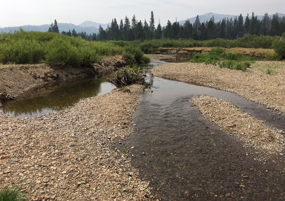
Continuing down the road, the road crosses the Rattlesnake Creek, which makes for a wonderful place to stop for a cold dip in the deep pool by the road. The weather was warm enough for a dip, but we didn't even soak our feet in the cold water.


Instead, we kept hiking until we came to the end of the road where we were greeted by cows trying to keep cool in the shade of the pines. From there we turned around to explore the spur road before heading back to camp.


We had to cross the ruff terrain of the road before making it back to the entrance by the day-use area. I have no idea how one drives over this section with the dips and boulders without causing damage to the undercarriage of their vehicle. We saw numerous areas which looked like oil leaked onto the boulders.


Back at camp, we called it a day of hiking. We rested and read about other places in the Stanislaus NF to explore.


After an extremely quiet evening and falling asleep to the sound of crickets, we awoke to explore more of the campground. We discovered a trail by the bridge and river that looked interesting to explore. One section of the trail starts at the bridge and goes to the back loop of the campground.


Beside the trail is an amphitheater area with a Miwok hut.


The hut wasn't very large, but I'm sure it served its purpose.


We back tracked to the bridge by way of walking the road through the campground and then a side trail down to the main trail. After crossing under the bridge we only walked a short distance to a manmade overlook.


The river is flowing fast through this section by the overlook.


Downstream were two guys fishing at a quiet pool of the river. They must of scrambled over the boulders to get to that spot.


The day was warming up quickly; so, we headed back to camp, rested a bit, and then packed up. Wakalu Hep Yo is a wonderful place to explore. Maybe we will return in the spring to check the river and plants that time of year. For now, we will explore other regions of the Sierras.

Saturday, August 25, 2018

Urban Hike Along the Hudson

We took some time off from the heat and smoke of California to visited our daughter in NYC. Nope, we didn't drive across country with our RV. And yes, the air quality was so much better in NYC. While visiting her, our daughter wanted us to go hiking up along the Hudson to see the beauty of the Hudson River and hike that region. So we took the train to Tarrytown, a very cute town, where we started our hike along the Croton Aqueduct after having a wonderful lunch in town. The Croton Aqueduct, one of the first in the US, carried water from Croton River to Manhattan until 1955.


Today the aqueduct is a trail that is about 26 miles long. We decided to hike the trail north passing by Sleepy Hollow, a high school, a weir, graveyards, beautiful houses, and old ventilators of the aqueduct until we reached Scarborough station, total hike of 6 miles.


We were lucky to see more than urban dwellings. A deer looked down at us as we hiked beside this rocky formation.


The Old Croton Trail took us by Rockefeller State Park, which looks like another fun place to hike and explore. We crossed over Route 9 and headed to Scarborough. When we got to Clear View School the trail detours along Route 9 where we passed the old entrance to Beechwood Estate.


The estate was once owned by Frank A. Vanderlip, president of National City Bank of New York from 1909 to 1919.


While he was vice president of the bank, he had two of the columns moved from Wall Street branch to his estate in Scarborough. The columns look so out of place along the road, but it reminded us of times so long ago when folks like Fords, Rockfellers, and many other famous folks would come here to relax from life in busy cities, like NYC.


Shortly after passing the once grand entrance, we walked on Scarborough Station Rd passing grand private estates until we came to this cute Post Office. There was a sign for overnight parking during certain times of the year. I commented on a possible free RV spot for the night if we ever make it this way by RV. At the train station, we realized we would have a long wait until the next train; so, we headed back to Tarrytown by way of Uber. Back at town we snacked on wonderful yummy pastries while sipping on excellent coffee and tea.

Saturday, August 11, 2018

HOPE

There's hope in that valley, I tell my husband as we headed out on a Saturday morning in hope of finding a site at Hope Valley Campground off of Hwy. 88.


We were trying to camp at a higher elevation in hope of escaping the heat that has been relentless this summer in the Bay Area-- lower 80s would be wonderful.


We knew the likelihood of snagging a unreserved site on a summer weekend was like zero, but we headed out anyways since there is lots of places to boondock off of Blue Lakes Rd.


We got lucky that we didn't have to travel too far, and we were lucky that we had nobody on either side of us or in front and back of us.


We nestled in-between trees that provide shade.


Even though the sky was filled with smoke from the numerous CA-fires burning throughout California, we had peaceful views from our campsite.


 After settling in and eating lunch, we headed off to the Tamarack parking area to hike along the PCT.


We passed numerous hikers heading north along the PCT with packs as we headed south towards Lily Pad Lake.


The trail was not difficult, no more strenuous than our Ridge trails close to home, just a bit tiring since we hadn't adjusted to the elevation of about 8400 ft.


The heat of the day was getting hotter, but we had chosen the direction south that provided us with shade from the pines. At the top of one climb, we were rewarded with the view looking south to the craggy range southeast of our destination.


Just when we were about to give up hope of hiking to Lily Pad Lake, we came across a PCT section hiker telling us that it isn't that much further--just after the dried up pond. There was only one couple resting and enjoying the peacefulness of this lake. There are numerous campsites for those wishing a place for the night. It sure was a wonderful place to rest and soak hot feet.


After resting, we headed back north to our car. Along the way back, we were rewarded with this view of the Nipple. I'm so glad we didn't head north that day since the hike to the Nipple is mostly open trail. That hike will have to be when the weather is much cooler.


Back at camp, we relaxed and went to sleep early--like all the other folks boondocking close by. It was so quiet...then early morning someone's dogs started barking at 6 AM...and barked and barked and barked.


We got up, ate, and explored the Valley. We discovered a trail at the end of the dirt road where we were camped and hiked a small portion of that.


 And then we headed down to the river to see its condition. We walked the dirt road checking out boondocking sites and met some friendly campers.


Yes, we would come back here to explore more of Hope Valley!

Monday, June 4, 2018

TeleLi puLaya

We tried to escaped the heat, but we didn't go up high enough in elevation.


We did have a private campsite, site #19, away from the main area, but too close to the camp host that has very yappy dogs. Each time someone walked by the camp host's site, the camp host's dogs would bark and bark.


Did I say it was hot? Yup, around 90. The weather service was calling for low 80s. They got that forecast all wrong.


We tried to hike a portion of 4N14, Spring Gap Rd, but we took the dirt road off the left instead of going straight. We hiked over to the power lines and then beyond the power lines until the trail faded out after a marshy meadow. We did see some cows running away from us. We heard them way before we saw them heading down the hill. We were the only folks out exploring the forest roads across from the campground.


We did see lots of beautiful yellow iris in bloom in the open field by the entrance to the campground.

Will we return here again? Most likely not since we have been here three times now. Plus, there are other places that are calling us to explore.

Thursday, May 10, 2018

Exploring Fraser Flat

It has been two years since my husband and I camped at Fraser Flat. We could only remember the beautiful hike on the Sugar Pine Railway Trail from Fraser Flat to Strawberry. We had forgotten the peacefulness of this campground.


Fraser Flat Campground is located along side the South Fork of the Stanislaus River. It was once a logging camp in 1927 called Camp Fraser. Just down the road, by the bridge, is the start of the Sugar Pine Railway Trail, an old railroad bed.


After setting up camp and eating lunch, we hiked the trail from the bridge up to Old Strawberry Road, 3 miles one-way.


For the majority of the way, the trail runs parallel with the river. One can hear the river below the trail.


This time hiking the trail, we crossed many seasonal creeks flowing down the hillsides to the river. Last time we hiked the trail was during the drought; so, none of the creeks were flowing.


We were lucky in coming across a couple of snow plants just starting to peek out of the ground. It's such a surprise seeing the vibrant red plants popping up in the forest's different shades and textures of brown ground cover.


 As we neared the end of the trail, close to the Strawberry end of the trail, we noticed this sign. Someone didn't want folks getting lost or wandering in the field close to the trailhead.


At the parking lot by the Old Strawberry Road trailhead, we noticed this sign.  There was an area with a level area that one could camp. We wondered if this sign got posted because the owner of the land was tired of people camping and trashing up his land. We have seen that within some National Forests of people leaving trash at dispersed campgrounds. After reading the sign, we made our gradual descent along the trail back to camp.


Back at camp, we set up our Biolite Camp Stove to make yummy pizza. We used Trader Joe's gluten-free pizza and added lots of toppings. The black on the pizza stone is the cornmeal. The bottom of the pizza wasn't burnt. The pizza came out nice and crispy on the bottom, perfect!  After cooking the pizza, we continued to fuel the stove with wood for a nice campfire by our RV. We had positioned the stove just under the awning of the RV so that the heat from the stove would be captured by the awning. That heat kept us warm for an hour as we listened to the night sounds of frogs and other campers before heading to bed for a restful sleep. 


The next day after a lazy morning and breakfast, we headed up the hill, 4N13, to explore the Philadelphia Ditch. This ditch is part of PG&E's hydroelectric system.


Water is diverted from the South Fork Stanislaus River about 1.5 miles upstream from the campground.


From there, the water flows though the ditch and across numerous wooden flumes for about 4.7 miles to Spring Gap Foreby. From there the water travels down a 1 mile penstock to the Spring Gap Powerhouse.


After exploring two of the wooden flumes, each in different directions, we opted to walk the fire-road that runs parallel above the ditch. I didn't want to try crossing the flume with our dog. We only encountered one Jeep traveling the road; otherwise, we had the road to ourself while enjoying the beauty of this area.


We discovered an area along the Philadelphia Ditch Trail that would make a great spot for a picnic. So, next time we come out to camp at Fraser Flat, we will set up camp and then head up to this area for lunch and more exploration.